The STL West region provides an advantage to businesses looking for a central location, affordable and reliable utility services and easy access to major markets.
Interstate Access
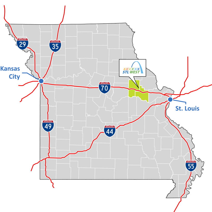
Interstate 70 is the primary route connecting St. Louis and Kansas City. The east to west route bisects the region and connects to I-55, I-44, I-64 and I-270 providing convenient access to nearby Midwest markets.
Rail and Port Access
Rail
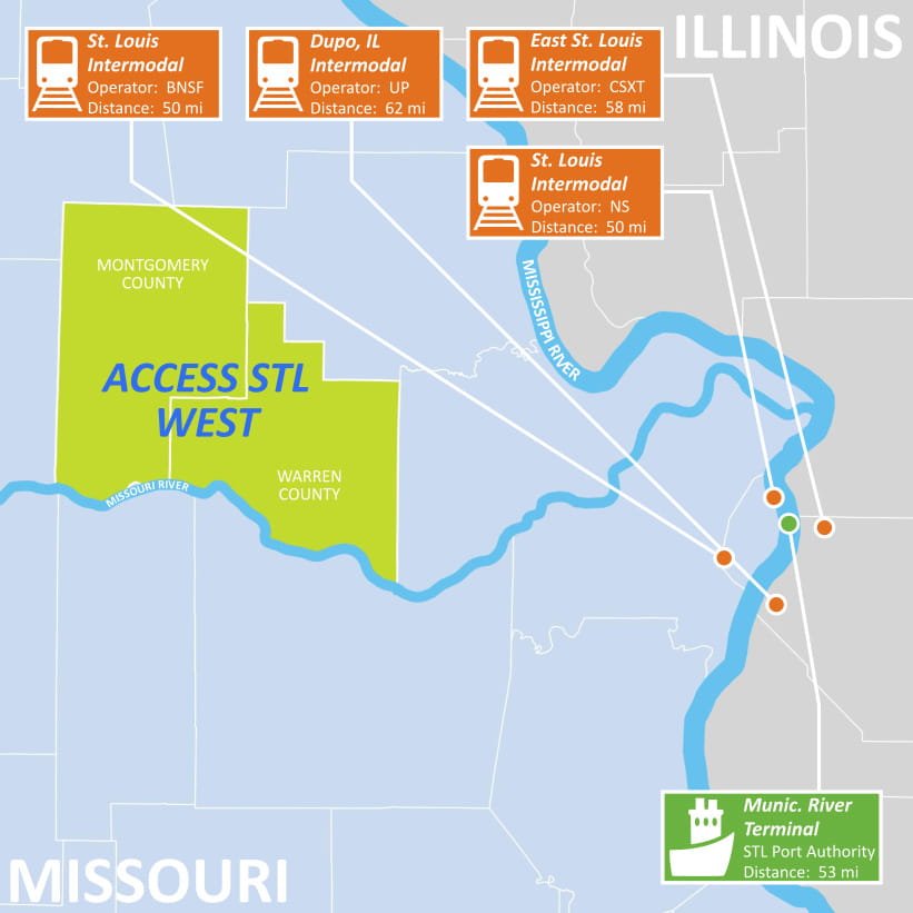
The STL West region is served by Norfolk Southern which operates nearly 19,500 route miles and serves every major container port in the eastern United States.
Port
St. Louis Municipal River Terminal (MRT) is adjacent to Interstate 70 in St. Louis, Missouri and is the only public general-purpose dock on west side of the Mississippi River.
Airport Access
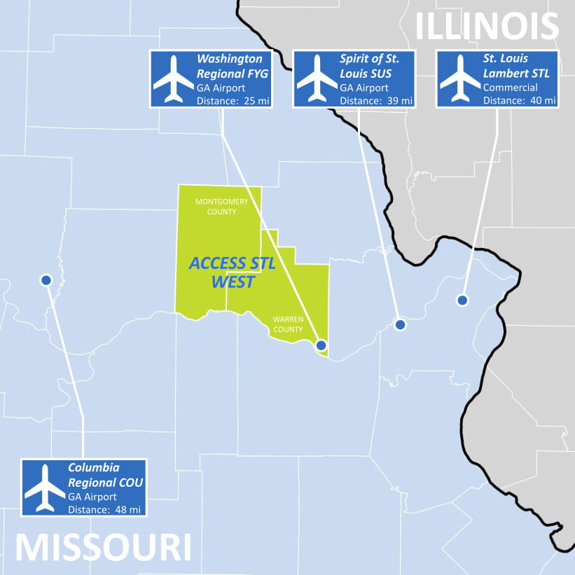
Washington Regional Airport (FYG) is located in southern Warren County 15 minutes south of I-70. The airport is open to the public and has a 5,000-foot runway equipped with AWOS night landing capability.
Spirit of St. Louis Airport (KSUS) is located west of the City of St. Louis’s central business district and is open to the public. The airport offers charter operations and has a 7,485-foot all weather runway, a 5,000-foot parallel runway, a FAA Control Tower and 24-hour customs services.
Columbia Regional Airport (COU) is located in Columbia, Missouri, west of the STL West region. The commercial airport is served by American and United Airlines with non-stop flights to Dallas/Fort Worth, Chicago O’Hare and Denver International airports.
St. Louis Lambert International Airport (STL) is located northeast of downtown St. Louis and provides commercial, cargo, and business services for the region. The airport has more than 259 daily departures and 74 nonstop flights to domestic and international locations.
Utilities
The STL West region is served by several utility partners each committed to providing quality service at competitive prices.
Electric Providers
Water & Wastewater Providers
Natural Gas Providers
Renewable Energy
The STL West region is growing its renewable energy footprint. By 2021, the region will have 445 MW of combined solar power allowing companies to diversify their energy options while receiving reliable and sustainable power.
Recent Announcements:
- Warren County – Two companies have secured 6,400 acres in Warren County for solar generation facility with a combined capacity of 439 MW.
- Montgomery County – Ameren Missouri announced in November 2020 that it will construct a 6 MW solar facility on 95 acres just outside of New Florence in Montgomery County.
Contact the Access STL West team to learn more about the region’s transportation and utility assets.